🎉 Up to 70% Off Selected ItemsShop Sale

Ben Nevis Summit Map
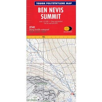
This Ben Nevis Summit Map is an enlarged map for hillwalkers covering the summit of Ben Nevis at a scale of 1:12,500, the highest mountain in the UK.
The map covers an area approximately 3km x 4km, and the size is 300mm x 400mm.
Harvey Summit maps are tough, light, and waterproof. They are intended to provide extra clarity and supplementary detail for a complex piece of mountain terrain, where fine navigation is required in bad conditions such as mist, darkness or snow.
$4.39
Original: $14.63
-70%Ben Nevis Summit Map—
$14.63
$4.39Ben Nevis Summit Map
This Ben Nevis Summit Map is an enlarged map for hillwalkers covering the summit of Ben Nevis at a scale of 1:12,500, the highest mountain in the UK.
The map covers an area approximately 3km x 4km, and the size is 300mm x 400mm.
Harvey Summit maps are tough, light, and waterproof. They are intended to provide extra clarity and supplementary detail for a complex piece of mountain terrain, where fine navigation is required in bad conditions such as mist, darkness or snow.
The map covers an area approximately 3km x 4km, and the size is 300mm x 400mm.
Harvey Summit maps are tough, light, and waterproof. They are intended to provide extra clarity and supplementary detail for a complex piece of mountain terrain, where fine navigation is required in bad conditions such as mist, darkness or snow.
Product Information
Product Information
Shipping & Returns
Shipping & Returns
Description
This Ben Nevis Summit Map is an enlarged map for hillwalkers covering the summit of Ben Nevis at a scale of 1:12,500, the highest mountain in the UK.
The map covers an area approximately 3km x 4km, and the size is 300mm x 400mm.
Harvey Summit maps are tough, light, and waterproof. They are intended to provide extra clarity and supplementary detail for a complex piece of mountain terrain, where fine navigation is required in bad conditions such as mist, darkness or snow.
The map covers an area approximately 3km x 4km, and the size is 300mm x 400mm.
Harvey Summit maps are tough, light, and waterproof. They are intended to provide extra clarity and supplementary detail for a complex piece of mountain terrain, where fine navigation is required in bad conditions such as mist, darkness or snow.