🎉 Up to 70% Off Selected ItemsShop Sale

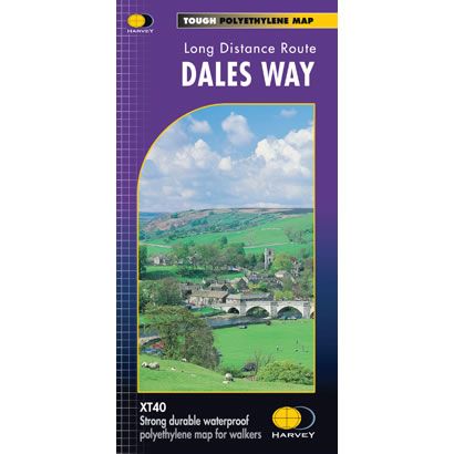
Dales Way XT40 Harvey Map
This is a complete map of the Dales Way long distance path showing the entire route on 1 map. This long distance path is 81 miles long and it starts at Ilkley in the Yorkshire Dales and finishes at Bowness on the shores of Lake Windermere in the Lake District. The Dales Way includes the full length of the Wharfedale valley, before crossing the Pennines, and onto the Lake District. There are also 3 Dales Way link routes from the nearby cities of Leeds, Shipley (Bradford) and Harrogate that are shown on the map.
The map includes logistical information for walking the Dales Way, including accommodation options, shops and refreshments. Directions to the start of the route are included plus enlargements of the local towns and villages showing what facilities are available.
Harvey XT40 Maps are printed on light, waterproof and tear-resistant synthetic paper, and it is GPS compatible. The map key and legend is in English, French and German text.
$26.66
Dales Way XT40 Harvey Map—
$26.66
Dales Way XT40 Harvey Map
This is a complete map of the Dales Way long distance path showing the entire route on 1 map. This long distance path is 81 miles long and it starts at Ilkley in the Yorkshire Dales and finishes at Bowness on the shores of Lake Windermere in the Lake District. The Dales Way includes the full length of the Wharfedale valley, before crossing the Pennines, and onto the Lake District. There are also 3 Dales Way link routes from the nearby cities of Leeds, Shipley (Bradford) and Harrogate that are shown on the map.
The map includes logistical information for walking the Dales Way, including accommodation options, shops and refreshments. Directions to the start of the route are included plus enlargements of the local towns and villages showing what facilities are available.
Harvey XT40 Maps are printed on light, waterproof and tear-resistant synthetic paper, and it is GPS compatible. The map key and legend is in English, French and German text.
The map includes logistical information for walking the Dales Way, including accommodation options, shops and refreshments. Directions to the start of the route are included plus enlargements of the local towns and villages showing what facilities are available.
Harvey XT40 Maps are printed on light, waterproof and tear-resistant synthetic paper, and it is GPS compatible. The map key and legend is in English, French and German text.
Product Information
Product Information
Shipping & Returns
Shipping & Returns
Description
This is a complete map of the Dales Way long distance path showing the entire route on 1 map. This long distance path is 81 miles long and it starts at Ilkley in the Yorkshire Dales and finishes at Bowness on the shores of Lake Windermere in the Lake District. The Dales Way includes the full length of the Wharfedale valley, before crossing the Pennines, and onto the Lake District. There are also 3 Dales Way link routes from the nearby cities of Leeds, Shipley (Bradford) and Harrogate that are shown on the map.
The map includes logistical information for walking the Dales Way, including accommodation options, shops and refreshments. Directions to the start of the route are included plus enlargements of the local towns and villages showing what facilities are available.
Harvey XT40 Maps are printed on light, waterproof and tear-resistant synthetic paper, and it is GPS compatible. The map key and legend is in English, French and German text.
The map includes logistical information for walking the Dales Way, including accommodation options, shops and refreshments. Directions to the start of the route are included plus enlargements of the local towns and villages showing what facilities are available.
Harvey XT40 Maps are printed on light, waterproof and tear-resistant synthetic paper, and it is GPS compatible. The map key and legend is in English, French and German text.