🎉 Up to 70% Off Selected ItemsShop Sale

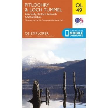
OS Explorer Map OL49 - Pitlochry and Loch Tummel
This OS Explorer OL49 Map covers Pitlochry and Loch Tummel , including Aberfeldy, Kinloch Rannoch, Schiehallion and part of the Cairngorms National Park.
The scale of this OL 49 Explorer map is 1:25,000 where 4cm equals 1km, or 2.5 inches equals 1 mile.
With this map you will receive a code for a free mobile download onto your smartphone or tablet (iOS or Android).
The scale of this OL 49 Explorer map is 1:25,000 where 4cm equals 1km, or 2.5 inches equals 1 mile.
With this map you will receive a code for a free mobile download onto your smartphone or tablet (iOS or Android).
Select Map Finish
From $5.21
Original: $17.36
-70%OS Explorer Map OL49 - Pitlochry and Loch Tummel—
$17.36
$5.21OS Explorer Map OL49 - Pitlochry and Loch Tummel
This OS Explorer OL49 Map covers Pitlochry and Loch Tummel , including Aberfeldy, Kinloch Rannoch, Schiehallion and part of the Cairngorms National Park.
The scale of this OL 49 Explorer map is 1:25,000 where 4cm equals 1km, or 2.5 inches equals 1 mile.
With this map you will receive a code for a free mobile download onto your smartphone or tablet (iOS or Android).
The scale of this OL 49 Explorer map is 1:25,000 where 4cm equals 1km, or 2.5 inches equals 1 mile.
With this map you will receive a code for a free mobile download onto your smartphone or tablet (iOS or Android).
Product Information
Product Information
Shipping & Returns
Shipping & Returns
Description
This OS Explorer OL49 Map covers Pitlochry and Loch Tummel , including Aberfeldy, Kinloch Rannoch, Schiehallion and part of the Cairngorms National Park.
The scale of this OL 49 Explorer map is 1:25,000 where 4cm equals 1km, or 2.5 inches equals 1 mile.
With this map you will receive a code for a free mobile download onto your smartphone or tablet (iOS or Android).
The scale of this OL 49 Explorer map is 1:25,000 where 4cm equals 1km, or 2.5 inches equals 1 mile.
With this map you will receive a code for a free mobile download onto your smartphone or tablet (iOS or Android).