🎉 Up to 70% Off Selected ItemsShop Sale

Thames Path XT40 Harvey Map
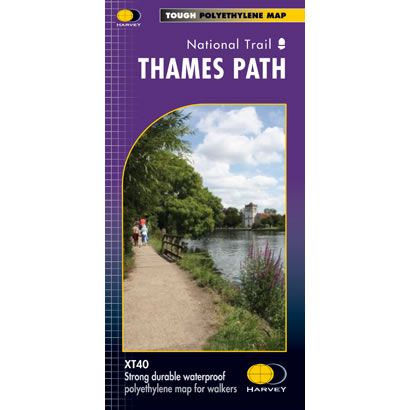
This is a complete map of the Thames Path National Trail Path showing the entire route on 1 sheet. This long distance path follows the Thames from its source in the Cotswolds, through central London, and finishing at the Thames Barrier where the River Thames meets the sea. The Trail is flat that makes for easy walking, and it passes through water meadows, historic towns and lovely villages.
The map includes logistical information for walking the Thames Path, including accommodation options, shops and refreshments. Directions to the start of the route are included plus enlargements of the local towns and villages showing what facilities are available.
Harvey XT40 Maps are printed on light, waterproof and tear-resistant synthetic paper, and it is GPS compatible. The map key and legend is in English, French and German text.
$26.66
Thames Path XT40 Harvey Map—
$26.66
Thames Path XT40 Harvey Map
This is a complete map of the Thames Path National Trail Path showing the entire route on 1 sheet. This long distance path follows the Thames from its source in the Cotswolds, through central London, and finishing at the Thames Barrier where the River Thames meets the sea. The Trail is flat that makes for easy walking, and it passes through water meadows, historic towns and lovely villages.
The map includes logistical information for walking the Thames Path, including accommodation options, shops and refreshments. Directions to the start of the route are included plus enlargements of the local towns and villages showing what facilities are available.
Harvey XT40 Maps are printed on light, waterproof and tear-resistant synthetic paper, and it is GPS compatible. The map key and legend is in English, French and German text.
The map includes logistical information for walking the Thames Path, including accommodation options, shops and refreshments. Directions to the start of the route are included plus enlargements of the local towns and villages showing what facilities are available.
Harvey XT40 Maps are printed on light, waterproof and tear-resistant synthetic paper, and it is GPS compatible. The map key and legend is in English, French and German text.
Product Information
Product Information
Shipping & Returns
Shipping & Returns
Description
This is a complete map of the Thames Path National Trail Path showing the entire route on 1 sheet. This long distance path follows the Thames from its source in the Cotswolds, through central London, and finishing at the Thames Barrier where the River Thames meets the sea. The Trail is flat that makes for easy walking, and it passes through water meadows, historic towns and lovely villages.
The map includes logistical information for walking the Thames Path, including accommodation options, shops and refreshments. Directions to the start of the route are included plus enlargements of the local towns and villages showing what facilities are available.
Harvey XT40 Maps are printed on light, waterproof and tear-resistant synthetic paper, and it is GPS compatible. The map key and legend is in English, French and German text.
The map includes logistical information for walking the Thames Path, including accommodation options, shops and refreshments. Directions to the start of the route are included plus enlargements of the local towns and villages showing what facilities are available.
Harvey XT40 Maps are printed on light, waterproof and tear-resistant synthetic paper, and it is GPS compatible. The map key and legend is in English, French and German text.